SSRZ Format
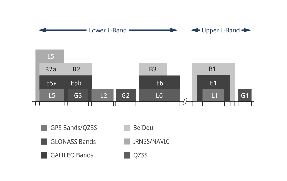
SSRZ is a general, highly flexible, open SSR correction format developed by Geo++. SSRZ includes various bandwidth-optimization concepts as well as flexible resolutions and message streams to allow for scalable positioning services or SSR corrections exchange.
The following table lists all SSRZ providers as of April 16, 2025, along with their corresponding organizations and relevant web resources.
SSRZ Provider ID |
Organization / Assignment |
Note |
| 33 | BKG | Federal Agency for Cartography and Geodesy (BKG) bkg.bund.de |
| 34 | ZSS | Satellitenpositionierungsdienst der deutschen Landesvermessung (SAPOS) www.zentrale-stelle-sapos.de |
| 34 | TERIA | EXAGONE www.reseau-teria.com |
| 35 | BEV | Bundesamt für Eich- und Vermessungswesen www.bev.gv.at |
| 36 | IGN | Instituto Geográfico Nacional de España www.ign.es/web/ign/portal |
| 37 | NLSC | National Land Surveying and Mapping Center www.nlsc.gov.tw |
| 38 | 06-GPS | 06-GPS www.06-gps.nl |